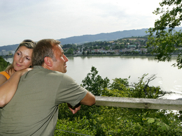
Aschach: Kobl loop
4082 Aschach an der Donau

Short enjoyment route with views over Aschach. The route is scenic and family-friendly.
Recommended season:
- April
- May
- June
- July
- August
- September
- October
- Loop
- Scenic
- Family friendly
- Insider tip
INTERESTING POINTS ALONG THE WAY:
- Cooper and Fishermen's Museum, Schopperplatz: open May – Sept.
- Parish Church Aschach on the Danube
SPIRITUAL HIKING ON THE DONAUSTEIG:
Bridges connect one shore with the other. When looking at the Aschach Danube Bridge, these impressions inspire me to interpret it as a symbol for my life.
- Where in my life have I crossed "bridges" to achieve the impossible, to overcome abysses?
- Who or what helped me? Who was a bridge for me?
- Where could I assume a bridging function for others?
- When was I a bridge builder?
- In which important life topics would I like to build bridges to continue well in the future?
Shipping has always played an important role along the Danube and remains significant today - whether excursion shipping, cabin cruises, or ferry rides. In Aschach, one can also visit the Cooper and Fishermen's Museum dedicated to a nearly forgotten craft.
Directions:The starting point is in Aschach directly at the church. At the café at the square we turn into Reitingerstr. and after about 300 m turn right and upwards. The street turns into a field path and leads uphill. Across fields and meadows we reach Vornholz. On lightly trafficked roads we descend to Aschach and go past the Cooper and Fishermen's Museum back to the starting point.Tip:
The route is also suitable for the summer months - many sections lead through cool forest areas.
The Aschach Schopper and Fishermen's Museum offers an overview of the historical craft of coopering as well as fishing then and now.
Also visit the barrier-free cultural hiking trail in Aschach and learn more about the history of the Danube market town.
Equipment:Hiking or sports shoes, backpack, outdoor clothing, rain or sun protectionAdditional information:
Tourism Association Aschach on the Danube
Kurzwernhartplatz 5
4082 Aschach a.d. Donau
Tel.: 0043 (0) 7273 / 6355
tourismus@aschach.at
www.tourismus-aschach.at
DONAUSTEIG HOSTS ALONG THE ROUTE:
Guesthouse „Sonne“, Kurzwernhartplatz 5, 4082 Aschach, Tel.: +43 7273 6308, www.aschach.at/gasthof.sonne
- traditional home cooking, rustic wine cellar, guests directly on the Danube bank
- 25 beds
Guesthouse „La Mamma“, Stiftstr. 1, 4082 Aschach, Tel.: +43 664 3135026, www.lamamma.at
- homemade pizzas and pasta
- 20 beds
Paths covering:
further information:
- Flatly


Getting there
Boat: with Danube shipping " Wurm + Noé " (Tel: 0732 / 783607) http://www.donauschiffahrt.de/gesamtuebersicht.html
Bike: Detailed information about the bike trail (Passau - Linz - Vienna) with bike hotels, sights along the route and other valuable information can be found at www.donauradweg.at
Bus: Post buses on 2 routes:
* From Linz via Ottensheim and Mühllacken to Aschach
* From Linz via Wilhering, Eferding to Aschach and onwards to Haibach, St. Agatha, Engelhartszell or Passau.
http://www.postbus.at/de/
Car: The Aschach Danube Bridge connects the upper Mühlviertel with the important economic area around Wels. Furthermore, Aschach is situated on the road from Linz to Passau.
Public Transit
Bus: From Linz via Ottensheim or via Wilhering, Eferding. www.postbus.at
Boat: Docking station directly in the village, www.donauschiffahrt.de
Parking
in the center of Aschach
- Suitable for kids (all ages)
- Suitable for families
- Suitable for children
- Spring
- Summer
- Autumn
Please get in touch for more information.
Kurzwernhartplatz 5
4082 Aschach an der Donau
Phone +43 7273 6355
E-Mail tourismus@aschach.at
Web www.tourismus-aschach.at
Web www.donausteig.com
https://www.donausteig.com
Suggest changes
Please let us know how we can improve the quality of this object or if there is any incorrect information on this page (eg. opening hours, contact, etc.).
Fields marked with an asterisk (*) are obligatory


