
Haibach: CICONIA circular route


4083 Haibach ob der Donau

Schlögen - Inzell - Steiner Felsen - Red Cross - Schlögener View - Schlögen
Recommended season:
- April
- May
- June
- July
- August
- September
- October
- Loop
- Scenic
- Geological highlights
- Botanical highlights
- Faunistic highlights
INTERESTING POINTS ALONG THE WAY:
Legendary cultural life:
- Remains of the Roman Danube fortress
- St. Nicholas Church
Natural space & movement:
- Bicycle ferry Schlögen – Au
- Longitudinal ferry Au – Inzell – Grafenau
SPIRITUAL HIKING ON THE DONAUSTEIG:
On the CICONIA adventure path, you immerse yourself in a past era. Not far from the starting point, there is a Roman excavation site to admire – a Roman bath and the fortress Ioviacum. Water has always played an important role in human life. After the ascent on the Donausteig, you reach a rock from which you can observe the Schlögener Loop. This formed by the power of water as the Danube fought its way through the Bohemian granite massif millions of years ago. All life comes from water, without water no life. Constant dripping wears away the stone.
- I give water new attention.
- Experience the Danube with its water masses from its southern bank.
- I observe dew drops, possibly raindrops, clouds, puddles.
- Let water flow over my hands, feel it on my skin, refresh myself.
- Drink – taste water, quench my thirst.
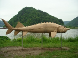
We hike on the approx. 10.5 km long CICONIA adventure path, which informs us with numerous stations and sculptures about the special features of this unique landscape and accompanies us from now on.
Along this circular path, hikers can immerse themselves in the unique natural habitat of the Upper Danube through information boards and adventure stations.
Near the hotel complex is an excavation site from Roman times (exposed western gate of the strompioneer settlement Ioviacum mentioned around 440 AD). Opposite the hotel, we enter the Ciconia path, which leads us after about 30 minutes of walking to the well-known viewpoint “Schlögener View.” This striking view of the Danube loop was chosen as the natural wonder of Upper Austria. We continue following the “Ciconia path” marking, come out of the forest at the Red Cross, and turn left onto the path towards Linetshub. Past ponds, we reach the Linetshub service road, turn left, and after a short stretch of asphalt road, again turn left onto the hiking trail. We reach the Au viewpoint. Here we again have a very beautiful view of the Danube loop. The path now leads through forest and meadows along the Danube slopes to the well-known viewpoint “Steiner Felsen.” We continue along the ridge and after a descent reach the village of Inzell. Here is the listed St. Nicholas Church. Now we follow the Inzell service road upstream along the Danube and reach our starting point Schlögen after 4 km.
The Kalvarienbergweg leads to the highest viewpoint in the municipality area (563 m). With clear visibility, you have a view from the Kalvarienberg Chapel from the Mühlviertel to the Dachstein massif. This unique landscape invites you to continue hiking to the Stauf ruins.Equipment:
Hiking backpack (including rain cover), sturdy footwearAdditional information:
Municipal office Haibach ob der Donau
Kirchenplatz 4
4083 Haibach ob der Donau
Tel.: 0043(0)7279/82 35
Fax: 0043(0)7279/82 35-16
haibach@oberoestereich.at
www.haibach-donau.at
DONAU STEIG INN ALONG THE ROUTE;
Hotel Donauschlinge
Schlögen 2, 4083 Haibach, Tel.: +43 7279 82 12
www.donauschlinge.at
- special recommendation: trout “Müllerin style” and a glass of Riesling
- 270 beds
Paths covering:
further information:
- Flatly
- Possible accommodation
Details - hiking
- themed path
- educational path
")

")
")

")
")
")

")
")
Getting there
Car: West motorway exit Linz or Wels towards Eferding, then continue on the B130 towards Passau
Train: Linz or Wels main station, continue by post bus towards Eferding - Haibach or
Passau main station, continue by post bus towards Linz
Plane: Linz/Hörsching airport
Ship: Schlögen ship landing stage
Public Transit
Train: Linz or Wels main station, continue by post bus towards Eferding - Haibach to Schlögen or Passau main station, continue by Upper Austria public transport bus towards Upper Austria / Linz – to Schlögen
Ship: Schlögen ship landing stage
Parking
Large parking areas at Hotel Donauschlinge
- Suitable for single travelers
- Suitable for friends
- Suitable for couples
- Spring
- Summer
- Autumn
Please get in touch for more information.
Kirchenplatz 4
4083 Haibach ob der Donau
mobile 677 61621401
E-Mail haibach@oberoestereich.at
Web www.donauregion.at/haibach
Web www.donauregion.at
https://www.donauregion.at
Altitude profile - Haibach: CICONIA circular route
Suggest changes
Please let us know how we can improve the quality of this object or if there is any incorrect information on this page (eg. opening hours, contact, etc.).
Please fill in all fields marked *.