
Donausteig stage 1_N01 Passau - Obernzell "Over the Bavarian Forest into the Danube Valley"


4040 Linz

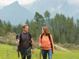
Donausteig - simply amazing! This stage takes us from the three-river city of Passau first over the rural high plateau of the Bavarian Forest, then through the original forest slope of the steep Danube hills to Obernzell on the Danube. Along the way, we discover Passau as the Bavarian Venice, the mother church of the Danube East, the Golden (Salt) Steig, the beauty of Bavaria, the natural jewel of the Danube hills, the Danube pearl Obernzell, ...
Recommended season:
- March
- April
- May
- June
- July
- August
- September
- October
- Multi-stage route
- Scenic
- Refreshment stops available
- Cultural/historical value
- Geological highlights
Seal of approval:
- Quality route according to "Österreichisches Wandergütesiegel"
This Donausteig stage starts in Passau, the Bavarian Venice! The historic city lies at the confluence of the Inn, Danube, and Ilz rivers in the forest-rich breakthrough valley of the upper Danube. From the Donausteig starting point, we walk through the picturesque old town on the peninsula between Inn and Danube. Italian flair, magnificent architecture, richly decorated facades, the magnificent St. Stephen's Cathedral, ... tell of prosperity and power – the residence city of the “Danube East”! After crossing the Danube, the Ludwig trail leads up the steep forest slope of the Danube hills. From the viewing platform above, we have a magnificent view of Passau – the city lies at our feet! Past the imposing Oberhaus fortress, the path curves right down to the Ilz River. Here in the Ilz city, the legendary Golden (Salt) Steig to Bohemia once began, which we now follow for a stretch. Through the settlement uphill, then further via a footpath, we reach the plateau of the atmospheric Ilz-Erlau highlands, an extension of the Bavarian Forest. Now a rolling cultural landscape shapes the scenery: lush meadows, fertile fields, extensive forests, scattered settlements, ... pure BavariaLand idyll! Via rural side roads, we soon reach the last settlement outskirts of the Passau city area. Then a meadow path begins, leading into the forest. Beautiful forest paths now lead past the forest clearing of the Erdbrüst wetland to the Hauzenberg main road. On a quiet side road follows the lonely forest settlement of Ziegelreuth, from which beautiful forest paths bring us back in a right curve to the Hauzenberg main road. We accompany this for about 1.2 km uphill, leaving the forest. Then it goes down a side road to the Grafmühle, then briefly along the Hörreuter stream downstream and finally up the opposite slope via forest and field paths to the farmers' hamlet Buchsee. There the Donausteig turns towards the Danube and quickly enters the atmospheric mixed forest of the steep Danube hills. At the terrain edge, the Donausteig rest area “Donaublick” offers an inspiring deep view into the Danube valley – truly a place to linger! An idyllic forest path first follows the terrain edge, then turns towards the hinterland, where we leave the forest near Wingersdorf. Now it goes again through the atmospheric cultural landscape of the rural plateau. Soon we stand on the panorama hill of König-Max height. Congratulations – this is the highest point of this Donausteig stage! The views extend far over the Bavarian Forest, the Bohemian Forest, the Sauwald, ... simply amazing! No wonder this is one of the key views of the Donausteig. A scenic country road now leads gently downhill to the farmers' hamlet Schörgendorf. After a field path, a forest road takes us down through the steep forest slope of the Danube hills to the Danube. Slightly downstream follows the Danube village Erlau. After a short street climb, we walk about 4 km on the idyllic hunter’s path at almost the same height through the original mixed forest of the steep Danube hills – a meditative natural pleasure! At the shelter on the hunter’s path, a beautiful view into the Danube valley makes us aware of its harmony. At the forest edge, we finally descend to Obernzell. Culture & nature – simply Donausteig!
Discover the following special features with the Donausteig diary:
- Passau – the Bavarian Venice
- Donausteig starting point “Passau”
- Ludwigplatz – the gate to the city
- Of cattle and cruise ships
- St. Paul’s parish church, the oldest parish church of Passau
- The Passau Tölpel, once a landmark!
- St. Stephen’s Cathedral, the mother church of the Danube East!
- Residence square – at the center of power
- ...
Download: Donausteig diary stage 1_N01 Passau-Obernzell
Directions:
From the Donausteig starting point “Passau”, we follow Bahnhofstraße eastwards to Ludwigplatz, then go slightly left in a wide right curve over Ludwigsstraße, Heuwinkel, Rindermarkt and Steinweg to Residenzplatz. The main exit to Domplatz allows a detour to St. Stephen's Cathedral. A few meters after the square, the Donausteig leads left through Schrottgasse down to the Danube bank. There to the right and over the Prinzregent-Luitpold bridge across the Danube. In a straight extension begins the steep Ludwigssteig, which takes us keeping left through the forest of the Danube hills up to their upper edge. At the top we arrive to the right at the Donausteig rest area “Oberhaus” and then to the main entrance of the Oberhaus fortress. Continuing on the access road, at the end of the sports facility, it goes in a right curve down to the Ilz bridge. From the opposite riverbank, Löwenmühlstraße leads half-right, then Mittelstraße in a left curve uphill to Säumertor (next to St. Bartholomew's Church). There left and immediately right again. After an ascending footpath, we stand on the rural plateau of the Ilz-Erlau highlands in front of the Ebnerhof. Now left on the asphalt road further. At the sports field also left and then straight over the main street. Now we leave the Passau city area. A meadow path brings us to the forest edge, then beautiful forest paths follow. In the forest clearing of the Erdbrüst wetland on the asphalt road right and after about 50 m left again into the forest. Soon comes the Hauzenberg main road, which we pass under. On the road opposite we finally arrive at Ziegelreuth. There before the village chapel right the settlement street uphill. In its extension, a footpath first follows the forest edge, then leads in a right curve through the forest. Back at the Hauzenberg main road, we accompany it on an asphalted foot/bike path uphill. After about 1.2 km under the road through and left the asphalt road down to the Grafmühle (Donausteig rest area). Now the Donausteig follows the creek downstream, crosses it on a footbridge and leads on forest and field paths up to the farmers’ hamlet Buchsee. Here right the field path down in the direction of the Danube. In a left curve we enter the forest of the Danube hills and soon reach their terrain edge at the Donausteig rest area "Donaublick". In the forest it goes further: first along the terrain edge, then onto the plateau. At the forest edge, the path finally turns left towards Wingersdorf. In the settlement at the crossroads left and immediately right again, then we stand on the König-Max height (Donausteig rest area). At the next two crossroads right, then at the east entry of Wingersdorf to the left downhill on the street. In Schörgendorf, the asphalt road turns into a field path. Later, the Donausteig turns right in the fields and leads on a forest road through the steep forest of the Danube hills down to Erlau. Across the railway tracks, we reach left the mouth of the Erlau River into the Danube. Here left on Haarer Straße uphill. At the first hairpin turn, we leave it and walk about 4 km on the idyllic Jägersteig past the Donausteig rest area “shelter on the Jägersteig” through the forest slope of the Danube hills. Afterwards, turn right downhill on the asphalt road and straight on to St. Margaretha Cemetery Church. There right over the cemetery stairs down, past the Market Church to the market square of Obernzell.
To facilitate your orientation, the Donausteig has been equipped with its own orientation system - the description can be found here .
Tip:
Passau is not only an architectural gem but also the key to many Donausteig experiences – definitely take time to explore!Equipment:
Besides personal hiking equipment, there are no special requirements.Additional information:
WGD Donau Upper Austria Tourism GmbH
Lindengasse 9
4040 Linz, Austria
Tel. +43(0)732/7277-800
Fax. +43(0)732/7277-804
info@donausteig.com
Passau Tourism e.V.
Bahnhofstraße 36
D-94032 Passau
Tel. +49(0)851/955980
Fax: +49(0)851/35107
e-mail: tourist-info@passau.de
www.tourismus.passau.de
Tourist Information Obernzell
Marktplatz 42
94130 Obernzell
Tel. +49(0)8591/9116119
Fax: +49(0)8591/9116150
tourismus@obernzell.de
www.obernzell.de
Paths covering:
further information:
- Multi-day tour
- Board possible

")


Direction information: Departure
Direction information: right
Direction information: Destination
")
Getting there
Passau main train station is located on the peninsula of Ortspitze about 350 m west of the Schanz Bridge (GPS: D‑94032 Passau, Hauptbahnhof).
Public Transit
Passau can be easily reached by train and bus. A return transfer from Obernzell is possible by bus. Information about schedules can be found at www.vlp-passau.de .
Parking
The city center of Passau is mostly a short-term parking zone. For long-term parkers, numerous paid parking garages and parking lots are available. Information about their locations and prices can be found here .
- Spring
- Summer
- Autumn
Please get in touch for more information.
Lindengasse 9
4040 Linz
Phone +43 732 7277 - 800
Fax machine +43 732 7277 - 804
E-Mail info@donauregion.at
Web www.donauregion.at
Altitude profile - Donausteig stage 1_N01 Passau - Obernzell "Over the Bavarian Forest into the Danube Valley"
Suggest changes
Please let us know how we can improve the quality of this object or if there is any incorrect information on this page (eg. opening hours, contact, etc.).
Please fill in all fields marked *.