Schmuggler-Wanderung
Path number: 17 - Wanderweg
Starting place: 4090 Engelhartszell
Destination: 4090 Engelhartszell
Marktplatz 61
4090 Engelhartszell
4090 Engelhartszell

This hiking trail has the trail number 17.
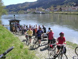
This hike starts in Engelhartszell at the Danube Stories exhibition (at the market town hall) and follows the "Danube Trail" to the Danube ferry, where you cross over to the other bank. Here you will find the start of hiking trail 678, the "Frauensteig". From here, the hiking trail belongs to the municipality of Neustift im Mühlkreis.After the forest, continue to Kleinmollsbeg and Forsetdt to the "Schürz" smugglers' inn. Follow the signs to Neustift. In the centre, leave the road 150 m before the customs building and turn left onto the Haitzendorf estate road. After 100 metres, turn right past the splinter silo to a path that leads to boundary stone 47.
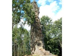
Follow the white-green-white markings to the village of Linden. Continue to Gottsdorf and along Riedler Straße to the historically interesting village of Riedl. You leave the castle ruins of "Neu- and Altjochenstein" behind you until you reach Jochenstein. Here, the "Haus am Strom" invites you to visit. After crossing the power station, you return to Engelhartszell, where it is worth stopping at the former imperial toll house.
- Suitable for groups
- Suitable for kids (6 - 10 Year)
- Suitable for single travelers
- Suitable for families
- Suitable for friends
- Suitable for couples
- Spring
- Summer
- Autumn
Please get in touch for more information.
Marktplatz 61
4090 Engelhartszell
Phone +43 7717 8055 - 16
E-Mail tourismus@engelhartszell.ooe.gv.at
Web www.engelhartszell.at
https://www.engelhartszell.at
Suggest changes
Please let us know how we can improve the quality of this object or if there is any incorrect information on this page (eg. opening hours, contact, etc.).
Please fill in all fields marked *.


