Medieval theme trail Via Scardinga


- Suitable for families
- Suitable for pushchairs
- culturally interesting
- Multi-day tour
- Flatly
Interactive elevation profile
Create PDF
Tour-Details
Paths covering:
Technique: *
Quality of experience: ******
Recommended season:
- March
- April
- May
- June
- July
- August
- September
- October
- November
Properties:
- Loop
- Multi-stage route
- Scenic
- Refreshment stops available
- Family friendly
- Cultural/historical value
- Geological highlights
- Faunistic highlights
- Insider tip
- Suitable for strollers
An exciting and entertaining journey into the past for young and old.
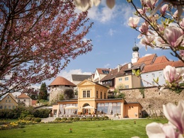
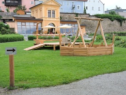
Pose for photos in knight’s armour. Listen to exciting stories and shudder in the face of draconian punishments. Learn about the history and crafts of the town and get actively involved with the goings-on. All this and more awaits visitors to the “Via Scardinga”. Immerse yourself into an exciting time journey through the history of the baroque town of Schärding. At 22 stations, some interactive, the Scardy-Mouse will tell you lots of interesting facts about life in the Middle Ages and reveal many a well-kept secret of the town. The model castle in the castle grounds gives a hint of how impressive the Schärding castle complex must once have been.
Tip:
Outing our families
Equipment:
No special equipment required
Additional information:
https://bit.ly/2XF2kR6
further information:
- Multi-day tour
- Flatly
- Board possible
Getting there
The starting point for the hiking trail is the shipping pier, located in L.-Kaiserweg 1.
Public Transit
How to arrive in the Danube Upper Austrian region?
The fast way to your destination – by train, bus, car, boat or plane.
Parking
Parking lot at shipping pier = 3 hours short-term parking zone with parking disc
Schärding town centre = fee-based short-term parking zone € 2.20 for 2 hours
Free parking = cemetery parking lot or at Alte Innbrücke bridge on the German side in Neuhaus am Inn
Schärding car park = per half hour € 0.60
- Suitable for pushchairs
- Spring
- Summer
- Autumn
- Early winter
Please get in touch for more information.
Lindengasse 9
4040 Linz
Phone +43 732 7277 - 800
Fax machine +43 732 7277 - 804
E-Mail info@donauregion.at
Web www.donauregion.at
Interactive elevation profile
Create PDF
Tour-Details
Paths covering:
Suggest changes
Please let us know how we can improve the quality of this object or if there is any incorrect information on this page (eg. opening hours, contact, etc.).
Please fill in all fields marked *.


