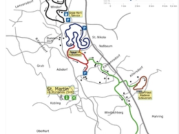
Hartl Loipe
Starting place: 4113 St. Martin im Mühlkreis
Destination: 4113 St. Martin im Mühlkreis
In operation
As soon as Mrs Holle shakes her pillows vigorously and the snow conditions allow, cross-country skiers make their tracks through the country in classic or skating style.
This trail is no longer groomed due to the many road crossings and the surface, which consists partly of granite gravel.- Suitable for groups
- Suitable for kids (10 - 14 Year)
- Deep winter
Please get in touch for more information.
4113 St. Martin im Mühlkreis
Phone +43 7232 2105
E-Mail gemeindeamt@sankt-martin.at
Web www.sankt-martin.at/
Web www.bergfex.at/oberoesterreich/lang…
https://www.sankt-martin.at/
https://www.bergfex.at/oberoesterreich/langlaufen/sankt-martin/loipen/1206/
https://www.bergfex.at/oberoesterreich/langlaufen/sankt-martin/loipen/1206/
Suggest changes
Please let us know how we can improve the quality of this object or if there is any incorrect information on this page (eg. opening hours, contact, etc.).
Please fill in all fields marked *.


