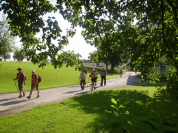
Jakobsweg
Starting place: 4780 Schärding
Destination: 5020 Salzburg
From Passau to Salzburg
This section of the Way of St James is a continuation of the pilgrimage route from Krumlov (Czech Republic) to Passau and connects the important episcopal cities of Passau and Salzburg.The route in Passau begins at St Stephen's Cathedral or at the Inn bridge. Via Neuburg von Vornbach you follow the left bank of the Inn to Schäriding. There you cross the Inn on the old bridge and orientate yourself from Schärding to Kirchdorf by the shell symbol on the yellow-blue marker boards of the Via Nova pilgrimage route.
Payment methods
Cash payment
- Suitable for groups
- Suitable for seniors
- Suitable for single travelers
- Suitable for friends
- Suitable for couples
- Spring
- Summer
- Autumn
Please get in touch for more information.
Innbruckstraße 29
4780 Schärding
Phone +43 7712 4300 - 0
Fax machine +43 7712 4320
E-Mail info@schaerding.info
Web www.schaerding.at
Web www.weitwanderwege.com/wege/jakobsw…
http://www.schaerding.at
https://www.weitwanderwege.com/wege/jakobsweg-innviertel/?etappe=1
https://www.weitwanderwege.com/wege/jakobsweg-innviertel/?etappe=1
Suggest changes
Please let us know how we can improve the quality of this object or if there is any incorrect information on this page (eg. opening hours, contact, etc.).
Please fill in all fields marked *.


