Haselmaus-Wanderung
Path number: 5 - Wanderweg
Starting place: 4090 Engelhartszell
Destination: 4090 Engelhartszell
Marktplatz 61
4090 Engelhartszell
4090 Engelhartszell

This hiking trail has the trail number 5.
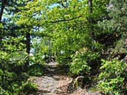
The so-called "Prälatensteig" begins at the Engelhartszell market town hall and leads uphill past the market church until shortly before the end of the village. Here the path turns left into a meadow path that leads along a garden fence to the Mühlbach stream.At the height of the monastery, the path leads right into the monastery forest and uphill to the "Haselmaus". At the little house in the middle of the forest, the fairy tale of Hansel and Gretel may spring to mind.
Then continue following the hiking trail markings to the rushing stream with the old hammer mill in Saag. Turn left at the main road and follow the "old" Niebelungenstraße at the edge of the forest to Engelszell Abbey.
Austria's only Trappist monastery is well worth a visit. Don't forget to sample the excellent monastery liqueur and Trappist cheese.
Parking
- Parking space: 10
- Charging point for electric cars (fees apply)
- Charging point for e-bikes (free of charge)
Payment methods
Cash payment
- Suitable for groups
- Suitable for schools
- Suitable for teenagers
- Suitable for seniors
- Suitable for single travelers
- Suitable for families
- Suitable for friends
- Suitable for couples
- Spring
- Summer
- Autumn
Please get in touch for more information.
Marktplatz 61
4090 Engelhartszell
Phone +43 7717 8055 - 16
E-Mail tourismus@engelhartszell.ooe.gv.at
Web www.engelhartszell.at
https://www.engelhartszell.at
https://www.engelhartszell.at
https://www.engelhartszell.at
Suggest changes
Please let us know how we can improve the quality of this object or if there is any incorrect information on this page (eg. opening hours, contact, etc.).
Please fill in all fields marked *.


