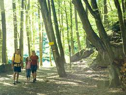
Panorama-Wanderung (15)
Starting place: 4090 St. Aegidi
Destination: 4090 St. Aegidi
Hike with panoramic views, trout circus
From the starting point in Engelhartszell, we follow the Sauwald road upwards, but leave it again at the first hairpin bend. We hike up through the forest towards St. Äigidi, but turn left at the edge of the forest after briefly meeting the Sauwald main road again. After a short detour, we reach the Moarfelsen panoramic viewpoint. After enjoying the view, we walk to St. ägigi, which we leave again via the road. At the turn-off at the edge of the forest, we take the side road and pass the Pamingerhof farm. Past the edge of the forest, we come to another road. We follow this road to the next section of forest and turn right. As we leave the forest, we come to the trout circus ( http://www.danube.at/sixcms/detail.php?id=106053&_nav=61207 ). From there we walk through the cultivated landscape and pass a panoramic view of the Sauwald panoramic road (Thron). We walk down through the forest and come to another panoramic spot, past which we follow the Donausteig to Engelhartszell.Accessibility
By car: Engelhartszell can be reached toll-free on the B 130 from Passau, Linz and Wels, as well as on the B 136 from Schärding.By train: Take the train to Linz, Wels, Schärding or Passau, then continue by federal bus or regional bus Ostbayern.
Boat: Travelling with the Wurm + Köck liner service from Passau and Linz is possible.
Tips
Engelszell Abbey - the only Trappist monastery in AustriaPanoramic view of Moarfelsen
Panoramic stage Engelhartszell
- Suitable for kids (all ages)
- Spring
- Summer
- Autumn
Please get in touch for more information.
St. Aegidi 10
4090 St. Aegidi
Phone +43 7717 7355 - 0
Fax machine +43 7717 7355 - 4
E-Mail gemeinde@st-aegidi.ooe.gv.at
Web www.st-aegidi.at
https://www.st-aegidi.at
Suggest changes
Please let us know how we can improve the quality of this object or if there is any incorrect information on this page (eg. opening hours, contact, etc.).
Please fill in all fields marked *.


