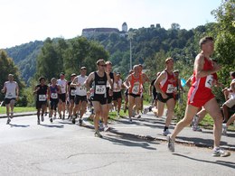
Lauf- und Bewegungspark "Unterer Inn"
Wernstein am Inn, Oberösterreich, Österreich
Running distances from easy to difficult, shortest distance 4,300 m, longest distance 31.15 km.
Experience the landscape, nature and diverse culture in the Inn Valley communities of Wernstein am Inn, Passau, Neuburg am Inn and Neuhaus am Inn. Perfectly signposted running and Nordic walking routes.Details can be found at http://maps.gisdat.at/bewegungspark_inn.
The Zweibrückenlauf takes place every year on the second Saturday in September in conjunction with the bridge festival. Course length 13.44 km, elevation profile 80 m.
4783 Wernstein am Inn
Phone +43 7713 7000
Fax machine +43 7713 7000 - 20
E-Mail gemeinde@wernstein-inn.ooe.gv.at
Web maps.gisdat.at/bewegungspark_inn
http://maps.gisdat.at/bewegungspark_inn
Please get in touch for more information.
Suggest changes
Please let us know how we can improve the quality of this object or if there is any incorrect information on this page (eg. opening hours, contact, etc.).
Please fill in all fields marked *.


