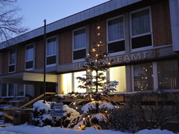
Gemeindeamt St. Aegidi
St. Aegidi, Oberösterreich, Österreich
Sankt Aegidi 10
4725 St. Aegidi
4725 St. Aegidi

Office hours
Mon - Fri 7.00 am - 12.00 noon and Mon, Tue and Thu 1.00 pm - 5.00 pm
and Fri 14.00 - 17.00
Party traffic
Mon - Fri mornings and Fri 2.00 - 5.00 pm
Area: 28.7 km²
Altitude: 599 m
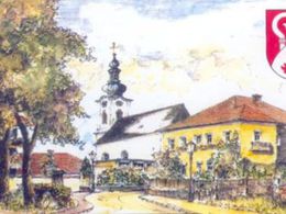
St. Aegidi was first mentioned on 24 August 1294 in a document from Engelszell Abbey. Around 1260, most of the villages in today's municipality of St. Aegidi were already mentioned in a Passau service register. The Passau Abbey was very dominant at the time. The Counts of Vichtenstein were originally a powerful dynasty of counts who had great influence here. In addition to the Vichtensteiners, the Lords of Wesen were also responsible for our region. The Wesen family were probably also the builders of the castle stable, of which only a ruin remains today. On 24 August 1294, Hadmar and Erchinger, brothers of Wesen, granted the Engelszell monastery lower jurisdiction over their estates in St. Gilgen' (St. Aegidi), Wizmansdorf (Witzenedt) and Grueb (probably Voglgrub). On 30 November 1325, Hademar von Waldeck bequeathed Sant Pangratien (St. Pankraz) to Engelhartszell Abbey in his will. This marked the beginning of a close relationship between St. Aegidi and Engelszell Abbey. St. Gilgen' (St. Aegidi) and St. Pankraz were subsequently two branch churches of Engelszell. The entire area to the west of the Keßlbach stream originally bore the name 'In der Kößla'. Today, this is essentially the parish area of St. Aegidi. The name was later changed to Niederkeßla. The Niederkeßla district court was part of the Peuerbach district court, over which the counts of Schaunberg exercised high jurisdiction. In 1324, Counts Heinrich and Ulrich von Schaunbeger sold the Niederkeßla district court to the bishop and thus to the chapter of Passau. This purchase was highly controversial and caused constant friction until the State Treaty of 1765. More details on the centuries-long dispute over the Niederkeßla can be found in the technical text above, where the border between Upper Austria and Passau (from Flenkental - Mühlbach - Vierling - Neuhofen - Filzmoos - Feicht, today the municipal border with Engelhartszell) as well as the border between Upper Austria and Bavaria (from Feicht - Königsedt, Grafendorf - Jungfraunstein, today the municipal border with Kopfing) was regularly checked, boundary stones were erected and border records were drawn up. Such border checks and border inspections are known from the years 1537, 1593, 1618, 1642, 1690, 1730 and 1765, and at the beginning of the War of the Spanish Succession (1700-1714), fortifications were built on the Austro-Bavarian border. One such large fortification can still be found in Dornedt today. However, there was no fighting here. In 1758, however, the hunter Richard Greiner from Eben 2 was shot dead by poachers on this border near Grafendorf. The 19th century brought major political changes: in 1810, the Niederkeßla district court was abolished and St. Aegidi was assigned to the Bavarian Waizenkirchen district court. The revolution of 1848 put an end to the rule of the nobility, the clergy and the estates. The new political municipalities were enshrined in law with the municipal code issued in 1849. The independence thus acquired did not last long, however, as St. Aegidi was incorporated into the municipality of Engelhartszell together with Vichtenstein by provincial law on 17 May 1874. The municipalities regained their independence as early as 1882. However, the boundaries of the predecessor municipalities do not coincide with today's municipal boundaries
4725 St. Aegidi
Phone +43 7717 7355
Fax machine +43 7717 7355 - 4
E-Mail gemeinde@st-aegidi.ooe.gv.at
Web www.st-aegidi.at
https://www.st-aegidi.at
Contact person
Mr Amtsleiter Thomas Fischer
St. Aegidi 10
Phone 7717 7355 - 15
Web www.st-aegidi.at
Closing day
- Saturday
- Sunday
- holiday
Parking
- Parking space: 10
- Parking area for disabled: 1
- Toilet facility
- All weather
- Suitable for groups
- Suitable for schools
- Suitable for kids (all ages)
- Pets allowed
- Suitable for teenagers
- Suitable for seniors
- Suitable for single travelers
- Suitable for friends
- Suitable for couples
- Suitable for children
Season
- Spring
- Summer
- Autumn
- Winter
Please get in touch for more information.
other information
- path width (min. 150 cm)
- door width (min. 80 cm)
- Escort required
Suggest changes
Please let us know how we can improve the quality of this object or if there is any incorrect information on this page (eg. opening hours, contact, etc.).
Fields marked with an asterisk (*) are obligatory


