


Symphony hiking trail Nr. 8


- Suitable for families
- culturally interesting
Interactive elevation profile
Create PDF
Tour-Details
Starting place: 4490 St. Florian
Destination: 4052 Ansfelden
duration: 2h 19m
length: 8,5 km
Altitude difference (uphill): 182m
Altitude difference (downhill): 194m
Lowest point: 281m
Highest point: 369m
difficulty: difficult
condition: very difficult
panoramic view: Dreamtour
Paths covering:
Asphalt, Path / trail, Street
powered by TOURDATA | Suggest a change
Short description:
Stift/Wetterhäuschen/Literaturgarten - Rohrbach - Forstholz - Ansfelden
Stift/Wetterhäuschen/Literaturgarten - Rohrbach - Forstholz - Ansfelden
Technique: ***
Quality of experience: ******
Recommended season:
- January
- February
- March
- April
- May
- June
- July
- August
- September
- October
- November
- December
Properties:
- Scenic
- Family friendly
- Cultural/historical value
- Insider tip
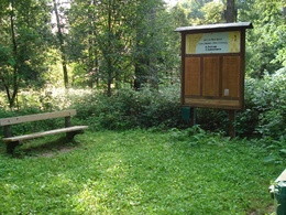
This culture walk leads through hilly forest landscape to Ansfelden in Anton Bruckner`s birthplace. Anton Bruckner was a choirboy in St. Florian and is sure to have used this trail often when visiting his parents. At 10 stations, presentation boards not only describe the 10 symphonies of Bruckner, but also touch on the historic background at the time of the composer.
Equipment:
good footwear is recommended
Starting point: Abbey / weather house / literature garden - Ansfelden
Destination: Abbey / weather house / literature garden - Ansfelden
further information:
Accessibility / arrival
Parking
Parking possibilities
Public Transit
How to arrive in the Danube Upper Austrian region?
The fast way to your destination – by train, bus, car, boat or plane.
Parking
Parking possibilities
Most economical season
- Spring
- Summer
- Autumn
- Early winter
- Deep winter
Please get in touch for more information.
Leopold-Kotzmann-Straße 1
4490 St. Florian
Phone +43 7224 4255 - 0
E-Mail gemeinde@st-florian.ooe.gv.at
Web www.st-florian.at
https://www.st-florian.at
Interactive elevation profile
Create PDF
Tour-Details
Starting place: 4490 St. Florian
Destination: 4052 Ansfelden
duration: 2h 19m
length: 8,5 km
Altitude difference (uphill): 182m
Altitude difference (downhill): 194m
Lowest point: 281m
Highest point: 369m
difficulty: difficult
condition: very difficult
panoramic view: Dreamtour
Paths covering:
Asphalt, Path / trail, Street
powered by TOURDATA | Suggest a change
Suggest changes
Please let us know how we can improve the quality of this object or if there is any incorrect information on this page (eg. opening hours, contact, etc.).
Please fill in all fields marked *.