


Enns Pilgrimage trail - Nr. 3


- Suitable for families
- culturally interesting
Interactive elevation profile
Create PDF
Tour-Details
Starting place: 4470 Enns
Destination: 4490 St. Florian
duration: 2h 39m
length: 10,8 km
Altitude difference (uphill): 75m
Altitude difference (downhill): 27m
Lowest point: 247m
Highest point: 295m
difficulty: difficult
condition: very difficult
panoramic view: Dreamtour
Paths covering:
Asphalt, Path / trail, Street
powered by TOURDATA | Suggest a change
Short description:
Ennsfluß/Florian-Gedenkkreuz - Basilika St. Laurenz - Eichberg - Samesleiten- Sumerauerhof - Weiling - Pröllsteg - Johanneskirche - Marktplatz - Basilika
Ennsfluß/Florian-Gedenkkreuz - Basilika St. Laurenz - Eichberg - Samesleiten- Sumerauerhof - Weiling - Pröllsteg - Johanneskirche - Marktplatz - Basilika
Technique: ****
Quality of experience: ******
Recommended season:
- January
- February
- March
- April
- May
- June
- July
- August
- September
- October
- November
- December
Properties:
- Scenic
- Family friendly
- Cultural/historical value
- Insider tip
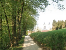
The pilgrimage trail starts at the assumed location of the martyrdom of St. Florian in the year 304 and leads as past testimony of the Roman history. A historic and art-historial highlight is the St. Laurenz Basilica. The trail also leads past "Sumerauerhof" open air museum, this is a classic square farmstead with a large collection of rustic furniture.
Equipment:
very good shoes are recommended
Starting point: Enns River / Florian - Abbey Basilica
Destination: Enns River / Florian - Abbey Basilica
further information:
Accessibility / arrival
Parking
Parking possibilities
Public Transit
How to arrive in the Danube Upper Austrian region?
The fast way to your destination – by train, bus, car, boat or plane.
Parking
Parking possibilities
Most economical season
- Spring
- Summer
- Autumn
- Early winter
- Deep winter
Please get in touch for more information.
Leopold-Kotzmann-Straße 1
4490 St. Florian
Phone +43 7224 4255 - 0
E-Mail gemeinde@st-florian.ooe.gv.at
Web www.st-florian.at
https://www.st-florian.at
Interactive elevation profile
Create PDF
Tour-Details
Starting place: 4470 Enns
Destination: 4490 St. Florian
duration: 2h 39m
length: 10,8 km
Altitude difference (uphill): 75m
Altitude difference (downhill): 27m
Lowest point: 247m
Highest point: 295m
difficulty: difficult
condition: very difficult
panoramic view: Dreamtour
Paths covering:
Asphalt, Path / trail, Street
powered by TOURDATA | Suggest a change
Suggest changes
Please let us know how we can improve the quality of this object or if there is any incorrect information on this page (eg. opening hours, contact, etc.).
Please fill in all fields marked *.