


MTB - Linz circuit


- Flatly
Interactive elevation profile
Create PDF
Tour-Details
Recommended season:
- April
- May
- June
- July
- August
- September
- October
- Loop
- Scenic
- Refreshment stops available
- Geological highlights
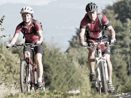
The Linz tour leads all passionate mountain bikers from the center of Upper Austria's capital city directly into the granite country of the Mühlviertel.
What the Mühlviertel has to offer the mountain biker, he learns right at the start: after the crispy steep Moarwies'n up to the Pöstlingberg was completed, may be partly technically challenging sections uphill and downhill through the hill country via Gramastetten, Eidenberg and Lichtenberg erradelt.
In addition to the panoramic views from the Pöstlingberg, the Danube view from the Koglerauspitz, the Giselawarte and finally at the Bachlberg Chapel, the integrated restaurants and the cultural capital Linz are sure to delight.


- Spring
- Summer
- Autumn
Please get in touch for more information.
Lindengasse 9
4040 Linz
Phone +43 732 7277 - 800
Fax machine +43 732 7277 - 804
E-Mail info@donauregion.at
Web www.donauregion.at
Interactive elevation profile
Create PDF
Tour-Details
MTB - Linz circuit
Suggest changes
Please let us know how we can improve the quality of this object or if there is any incorrect information on this page (eg. opening hours, contact, etc.).
Please fill in all fields marked *.