
© ©WGDDonauOberoesterreichTourismusGmbHCMVisuals Donauradweg reloaded, Schlögener Schlinge, Donauschlinge, Schlögenerschlinge, Haibach


Franzosenhütte Rundweg


- Flatly
Interactive elevation profile
Create PDF
Tour-Details
Starting place: 4362 Bad Kreuzen
Destination: 4362 Bad Kreuzen
duration: 2h 51m
length: 9,8 km
Altitude difference (uphill): 226m
Altitude difference (downhill): 226m
Lowest point: 441m
Highest point: 585m
difficulty: medium
condition: medium
panoramic view: Individual Views
Paths covering:
Hiking trail
powered by TOURDATA | Suggest a change
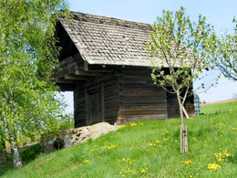
12 Franzosenhütte (circular route 9,700 m)
You start at the large car park through the Pfarrerwald forest and hike up the valley to the "Stelzhamer spring".
Cross the road, turn left and walk along the path in front of the Kriechbaumer chapel. When you stand on the dome, you can enjoy a marvellous panorama over the valley and the Mühlviertel hills. Continue down the valley to the Franzosenhütte (5,800m), where you can take a short break. Then walk a short distance along the road and turn right at Haus Palmetshofer (6,390m). At the Marthofer crossroads (7,390m), take the fork to the right up a dirt track. At the Wenigwieser house, turn right and walk up the goods road and via the Maria Hilf Chapel (9,000m) you return to the village.
Most economical season
- Summer
Please get in touch for more information.
Nr. 20a
4362 Bad Kreuzen
mobile +43 681 20583484
E-Mail info@gsundleben.at
Web www.donauregion.at/index.php?id=171…
Web www.bad-kreuzen.at/
https://www.donauregion.at/index.php?id=17179&L=0
https://www.bad-kreuzen.at/
https://www.bad-kreuzen.at/
Interactive elevation profile
Create PDF
Tour-Details
Starting place: 4362 Bad Kreuzen
Destination: 4362 Bad Kreuzen
duration: 2h 51m
length: 9,8 km
Altitude difference (uphill): 226m
Altitude difference (downhill): 226m
Lowest point: 441m
Highest point: 585m
difficulty: medium
condition: medium
panoramic view: Individual Views
Paths covering:
Hiking trail
powered by TOURDATA | Suggest a change
Franzosenhütte Rundweg
Suggest changes
Please let us know how we can improve the quality of this object or if there is any incorrect information on this page (eg. opening hours, contact, etc.).
Please fill in all fields marked *.