


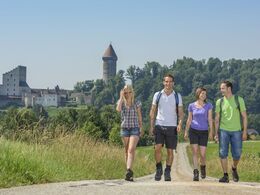
Wanderweg Burg Clam


Interactive elevation profile
Create PDF
Tour-Details
Starting place: 4362 Bad Kreuzen
Destination: 4352 Klam
duration: 1h 55m
length: 7,1 km
Altitude difference (uphill): 60m
Altitude difference (downhill): 197m
Lowest point: 277m
Highest point: 463m
difficulty: medium
condition: medium
panoramic view: Some Views
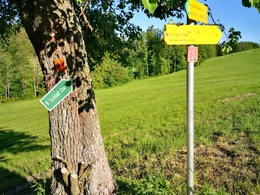
Paths covering:
Asphalt
powered by TOURDATA | Suggest a change
9 Burg Clam (7.200m)
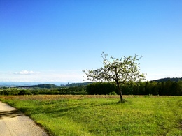
You have this beautiful hiking destination in front of you for almost the entire approach. You leave the market through the Postgassl and reach Bad Kreuzner-Straße at the Rieglersäge, which you follow to the right as far as Sulzer. Here you hike down the goods road to Mitterfellner (1,915 m) and across the meadow bottom of the Kreuzböckbach stream to Brandstetter and from there along the goods road to the Kreuzböckbrücke bridge. A meadow path to the right of the stream leads you to the goods road that crosses the Klambach near the Aschermühle (4,360 m) and continues through a settlement to Burghofer. The meadow path begins immediately to the right after the bridge and rejoins the goods road just before Klam. The stamping point is at the Fraundorfer inn. The Schlossberg appears as a gentle hill from the market town of Klam, but it drops steeply and deeply towards the Klam gorge. Follow the road towards Baumgartenberg as far as the oak chapel (trunk of the 1,000-year-old oak tree), where the ascent to Clam Castle begins.
Clam Castle was first mentioned in a document in 1128. It was owned by the Lords of Machland around 1149 and has been in the family of the Counts of Clam-Martinic since 1454.
The castle museum of the count family with a guided tour through the castle (armoury, Gothic chapel from 1491, porcelain collection etc.) is worth a visit.
Below the castle there is a castle pub in the Meierhof next to the Strudengau riding hall.
The Strindberghaus is located on the slope opposite the town hall in the village. The Swedish poet August Strindberg stayed in Klam several times between 1883 and 1893. The Stindberg Trail through the Klam Gorge commemorates his stay. A museum in Saxen is dedicated to the poet.
It takes around 30 minutes to reach Saxen via the romantic Klamschlucht gorge and you can take the train to Grein and the bus back to Bad Kreuzen.
Most economical season
- Summer
Please get in touch for more information.
Nr. 20a
4362 Bad Kreuzen
mobile +43 681 20583484
E-Mail info@gsundleben.at
Web www.gsundleben.at
Web www.bad-kreuzen.at
http://www.gsundleben.at
http://www.bad-kreuzen.at
http://www.bad-kreuzen.at
Interactive elevation profile
Create PDF
Tour-Details
Starting place: 4362 Bad Kreuzen
Destination: 4352 Klam
duration: 1h 55m
length: 7,1 km
Altitude difference (uphill): 60m
Altitude difference (downhill): 197m
Lowest point: 277m
Highest point: 463m
difficulty: medium
condition: medium
panoramic view: Some Views
Paths covering:
Asphalt
powered by TOURDATA | Suggest a change
Suggest changes
Please let us know how we can improve the quality of this object or if there is any incorrect information on this page (eg. opening hours, contact, etc.).
Please fill in all fields marked *.