


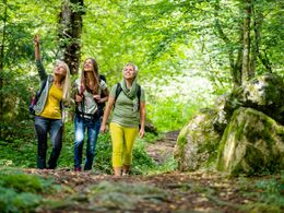
Wanderweg St. Thomas Höhenweg


Interactive elevation profile
Create PDF
Tour-Details
Starting place: 4362 Bad Kreuzen
Destination: 4364 St. Thomas am Blasenstein
duration: 2h 42m
length: 8,4 km
Altitude difference (uphill): 376m
Altitude difference (downhill): 135m
Lowest point: 359m
Highest point: 710m
difficulty: medium
condition: medium
panoramic view: Individual Views
Paths covering:
Hiking trail
powered by TOURDATA | Suggest a change
6 High trail to St. Thomas (8,500m)
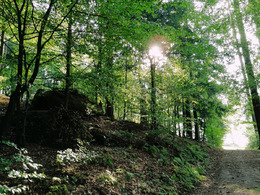
St. Thomas am Balsenstein is known for its "Bucklwehluckn". Head westwards via the Hinterkirner farm (see trail 4a) into the Thomastal valley. At Klein Freinhofer you come to Klingenbergstraße (1,760 m), on which you continue right for 50 m and then turn left across the meadow. A narrow footbridge leads over the Klausbach stream and a forest path then climbs steeply up to the Bairhofer chapel. Here you come to the goods road, which you leave again at Kronegger and climb up to the Thomasreith plateau (beautiful panoramic view). At the Edmayr chapel (4,130 m) you reach the Größing goods road, which you follow between meadows and fields to Saxenegger Straße. Continue along this road in a northerly direction to the Martaler Chapel (6,380 m) and climb up the S1 procession path lined with chapels to St. Thomas am Blasenstein on the left. St. Thomas am Blasenstein at 722 metres above sea level is known far and wide as a vantage point and for its "Bucklwehluckn". Two large granite blocks form the Bucklwehluckn on a rock plateau. If you squeeze through this narrow crevice, you will be cured of all back pain.
Today, the parish church of St Thomas, which is well worth seeing, stands on the elevated rocky plateau of the former castle "Castrum Plasenstain". In its lower church rests the mummified body of the 18th century canon Franz Xaverius Sydler de Rosenegg, popularly known as the "luftg'selchter Pfarrer".
Most economical season
- Spring
- Summer
- Autumn
Please get in touch for more information.
Nr. 20a
4362 Bad Kreuzen
mobile +43 681 20583484
E-Mail info@gsundleben.at
Web www.gsundleben.at
Web www.bad-kreuzen.at
http://www.gsundleben.at
http://www.bad-kreuzen.at
http://www.bad-kreuzen.at
Interactive elevation profile
Create PDF
Tour-Details
Starting place: 4362 Bad Kreuzen
Destination: 4364 St. Thomas am Blasenstein
duration: 2h 42m
length: 8,4 km
Altitude difference (uphill): 376m
Altitude difference (downhill): 135m
Lowest point: 359m
Highest point: 710m
difficulty: medium
condition: medium
panoramic view: Individual Views
Paths covering:
Hiking trail
powered by TOURDATA | Suggest a change
Suggest changes
Please let us know how we can improve the quality of this object or if there is any incorrect information on this page (eg. opening hours, contact, etc.).
Please fill in all fields marked *.