Wanderweg Ruine Klingenberg
Starting place: 4362 Bad Kreuzen
Destination: 4362 Bad Kreuzen
Nr. 20a
4362 Bad Kreuzen
4362 Bad Kreuzen

Klingenberg was once one of the most imposing castles in this region. Klingenberg was first mentioned in a document in 1217.
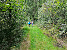
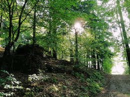
The hiking trail up to the Klingenberg ruins is extremely varied in terms of landscape. Firstly, the trail heads westwards via the Hinterkirner farm down into the Thomastal valley. Now follow the road past the Gasthof zum stillen Tal until you reach the bridge over the Senftmühlbach stream. Here you have to hike up the Senftmühlbach valley. At the Senftmühle (5,500m) you come to the road, which you follow for a short distance in the direction of Pabneukirchen. On the left over the bridge, the path leads into the valley of the Willersdorferbach stream. The valley now climbs moderately up to the Holzhackerhaus Steiner (7,300m). From here, the trail heads uphill through the Lange Wald and Höll to Waldpeter. There you reach the goods road that leads up to the Grabner Alm (9,650m). After a well-earned rest, you walk through the meadow and a forest path to the Panholzer and further up to the forester's lodge (10,600m) of the Linz Cathedral Chapter. A forest path leads to the Klingenberg and a forest path to the ruins.From the Klingenberg ruins, you can take the forest path - marked S8 - back to Bad Kreuzen via Waldpeter or continue to St. Thomas am Blasenstein. A path also leads from the forester's lodge to Pabneukirchen.
Most economical season
- Spring
- Summer
- Autumn
Please get in touch for more information.
Nr. 20a
4362 Bad Kreuzen
mobile +43 681 20583484
E-Mail info@gsundleben.at
Web www.donauregion.at/index.php?id=171…
Web www.bad-kreuzen.at/
https://www.donauregion.at/index.php?id=17179&L=0
https://www.bad-kreuzen.at/
https://www.bad-kreuzen.at/
Suggest changes
Please let us know how we can improve the quality of this object or if there is any incorrect information on this page (eg. opening hours, contact, etc.).
Please fill in all fields marked *.


