


Steyregg: Steyregg Loop Trail


- Suitable for families
- Flatly
Interactive elevation profile
Create PDF
Tour-Details
Starting place: 4221 Steyregg
Destination: 4221 Steyregg
duration: 3h 0m
length: 8,6 km
Altitude difference (uphill): 257m
Altitude difference (downhill): 257m
Lowest point: 253m
Highest point: 510m
difficulty: medium
condition: difficult
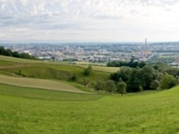
panoramic view: Great panorama
Paths covering:
Asphalt, Gravel, Other
powered by TOURDATA | Suggest a change
Short description:
Obernbergen - Stoettner - Finstergraben - Steyregg
Obernbergen - Stoettner - Finstergraben - Steyregg
Technique: **
Quality of experience: ****
Recommended season:
- April
- May
- June
- July
- August
- September
- October
Properties:
- Loop
- Scenic
- Refreshment stops available
- Family friendly
The starting place is in Steyregg (meadow at the tennis court or children playground resp. on Mauthausener Straße road). We hike westwards on Weißenwolfstraße road. At the end of the road we turn into Kirchengasse road. We leave Steyregg and head uphill to Pfenningberg. At a farm we take a right turn and follow Donausteig Trail. At a junction we head downhill through the forest towards Finstergrabenbach and hike past a quarry back to Steyregg.
Directions:
In Steyregg starten wir beim Startplatz (Wiese beim Tennsplatz bzw. Kinderspielplatz an der Mauthausener Straße) und wandern Richtung Westen auf der Weißenwolfstraße. Am Ende biegen wir in die Kirchengasse ein. Wir wandern aus Steyregg hinaus auf den Pfenningerg hinauf. Bei einem Bauernhof biegen wir rechts ab und folgen dem Donausteig. Bei einer Abzweigung biegen wir durch den Wald hinunter in den Finstergrabenbach ab und wandern vorbei an einem Steinbruch zurück nach Steyregg.
Tip:
Diese Tour wird Ihnen präsentiert von der Tourismusregion Donau Oberösterreich
Equipment:
Wanderrucksack (inkl. Regenhülle), festes Schuhwerk
Additional information:
Steyregg Municipal Office
Weissenwolffstr. 2
4221 Steyregg
Tel.: 0043(0)732/640155
Fax: 0043(0)732/640555
E-mail: office@steyregg.at
www.steyregg.at
Starting point: Steyregg
Destination: Wiese beim Tennisplatz bzw. Kinderspielplatz an der Mauthausener Straße, Steyregg
further information:
- Flatly
- Board possible
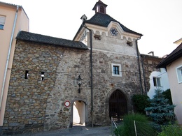
Startplatz Steyregg

Startplatz Steyregg
Accessibility / arrival
Getting there
By car, train (www.oebb.at), bus (www.postbus.at)
Public Transit
Train (www.oebb.at), bus (www.postbus.at)
Parking
Centre of Steyregg and directly at the starting place
Most economical season
- Spring
- Summer
- Autumn
Please get in touch for more information.
Weissenwolffstraße 3
4221 Steyregg
Phone +43 732 640155
E-Mail office@steyregg.at
Web www.steyregg.at
Web www.donauregion.at
https://www.steyregg.at
http://www.donauregion.at
http://www.donauregion.at
Interactive elevation profile
Create PDF
Tour-Details
Starting place: 4221 Steyregg
Destination: 4221 Steyregg
duration: 3h 0m
length: 8,6 km
Altitude difference (uphill): 257m
Altitude difference (downhill): 257m
Lowest point: 253m
Highest point: 510m
difficulty: medium
condition: difficult
panoramic view: Great panorama
Paths covering:
Asphalt, Gravel, Other
powered by TOURDATA | Suggest a change
Suggest changes
Please let us know how we can improve the quality of this object or if there is any incorrect information on this page (eg. opening hours, contact, etc.).
Please fill in all fields marked *.