


Tauern Bike Path R3a


- culinary interesting
- culturally interesting
- Multi-day tour
Interactive elevation profile
Create PDF
Tour-Details
Path number: R3a
Starting place: 94036 Passau
Destination: 5743 Krimml
duration: 17h 42m
length: 267,8 km
Altitude difference (uphill): 960m
Altitude difference (downhill): 202m
Lowest point: 299m
Highest point: 1.057m
difficulty: medium
condition: medium
panoramic view: Some Views
Paths covering:
Asphalt
powered by TOURDATA | Suggest a change
Full distance: Krimml to Passau 325 km
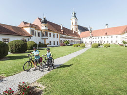
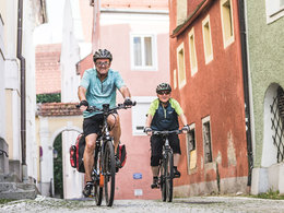
On the Tauern Bike Path, you will take an Alpine journey from Krimml, with its famous waterfalls, all the way to the three-river city of Passau. If you are travelling along the Tauern Bike Path in Upper Austria, you first follow the Salzach, which represents the border to Bavaria. After passing Bavarian Burghausen, you arrive at the spot where the Salzach empties into the Inn. In this area, the Tauern Bike Path leads you through the peaceful riparian landscapes of the Salzach and Inn. Along their banks lie the mariners' market of Oberndorf, Gothic Braunau, 1,000-year-old Obernberg, the Augustine monastery in Reichersberg, the Baroque city of Schärding, Wernstein Fortress and – once you have arrived at your destination – the three-river city of Passau.
On the Tauern Bike Path, you will take an Alpine journey from Krimml, with its famous waterfalls, all the way to the three-river city of Passau. If you are travelling along the Tauern Bike Path in Upper Austria, you first follow the Salzach, which represents the border to Bavaria. After passing Bavarian Burghausen, you arrive at the spot where the Salzach empties into the Inn. In this area, the Tauern Bike Path leads you through the peaceful riparian landscapes of the Salzach and Inn. Along their banks lie the mariners' market of Oberndorf, Gothic Braunau, 1,000-year-old Obernberg, the Augustine monastery in Reichersberg, the Baroque city of Schärding, Wernstein Fortress and – once you have arrived at your destination – the three-river city of Passau.
Accessibility / arrival
Train service is a suitable option for arrival. In order to arrive right at the Tauern Bike Path, the ideal stops are Salzburg, Saalfelden and Zell am See. Detailed information about train schedules is available from the ÖBB, Austrian Federal Railways.
Most economical season
- Spring
- Summer
- Autumn
Please get in touch for more information.
Innbruckstraße 29
4780 Schärding
Phone +43 7712 4300 - 0
Fax machine +43 7712 4320
E-Mail info@schaerding.info
Web www.schaerding.info
Web www.tauernradweg.at
http://www.schaerding.info
http://www.tauernradweg.at
http://www.tauernradweg.at
Interactive elevation profile
Create PDF
Tour-Details
Path number: R3a
Starting place: 94036 Passau
Destination: 5743 Krimml
duration: 17h 42m
length: 267,8 km
Altitude difference (uphill): 960m
Altitude difference (downhill): 202m
Lowest point: 299m
Highest point: 1.057m
difficulty: medium
condition: medium
panoramic view: Some Views
Paths covering:
Asphalt
powered by TOURDATA | Suggest a change
Suggest changes
Please let us know how we can improve the quality of this object or if there is any incorrect information on this page (eg. opening hours, contact, etc.).
Please fill in all fields marked *.