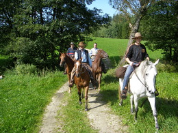
© ©WGDDonauOberoesterreichTourismusGmbHCMVisuals Donauradweg reloaded, Schlögener Schlinge, Donauschlinge, Schlögenerschlinge, Haibach
Search
Search
Close

Jungfraunstein-Wanderung

  • Flatly

 Interactive elevation profile

Download GPS data
Create PDF

Tour-Details

Path number: 9 - Wanderweg
Starting place: 4725 St. Aegidi
Destination: 4725 St. Aegidi

duration: 3h 0m
length: 12,1 km
Altitude difference (uphill): 302m
Altitude difference (downhill): 299m

Lowest point: 535m
Highest point: 655m
difficulty: easy
condition: medium
panoramic view: Individual Views

Paths covering:
Asphalt, Gravel

powered by TOURDATA | Suggest a change

The Jungfraunstein route has the path number 3.
Numerous hamlets and gems line the route of the Jungfraunstein circuit. Starting from St. Aegidi, you pass the villages of Lehen, Grübl, Fraunhof, Edern and Sagedt. A forest path leads through wide forests to the Jungfraunstein, a Celtic sacrificial site surrounded by numerous legends. Before Dornedt, the trail takes you past the entrenchments from the time of the Spanish Wars of Succession. The route continues via Voglgrub, Walleiten and Kößlau back to St. Aegidi.
Travelling by public transport
Route planner for independent travellers
  • Suitable for single travelers
  • Suitable for friends
  • Suitable for couples
Most economical season
  • Spring
  • Summer
  • Autumn
  • Early winter

Please get in touch for more information.


Jungfraunstein-Wanderung
Gemeinde St. Aegidi
St. Aegidi 10
4725 St. Aegidi

Phone +43 7717 7355 - 0
Fax machine +43 7717 7355 - 4
E-Mail gemeinde@st-aegidi.ooe.gv.at
Web www.st-aegidi.at
http://www.st-aegidi.at

We speak the following languages

German

 Interactive elevation profile

Download GPS data
Create PDF

Tour-Details

Path number: 9 - Wanderweg
Starting place: 4725 St. Aegidi
Destination: 4725 St. Aegidi

duration: 3h 0m
length: 12,1 km
Altitude difference (uphill): 302m
Altitude difference (downhill): 299m

Lowest point: 535m
Highest point: 655m
difficulty: easy
condition: medium
panoramic view: Individual Views

Paths covering:
Asphalt, Gravel

powered by TOURDATA | Suggest a change