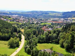
© Greinburg Castle © Oberösterreich Tourismus GmbH / Susanne Einzenberger
Greinburg Castle © Oberösterreich Tourismus GmbH / Susanne Einzenberger
search
Search
Close

THE PATH OF SALT - Linz to Rainbach im Mühlkreis

  • culturally interesting
  • Possible accommodation

 Interactive elevation profile

Download GPS data
Create PDF

Tour-Details

Path number: Etappe 5
Starting place: 4020 Linz
Destination: 4261 Rainbach im Mühlkreis

duration: 16h 32m
length: 60,4 km
Altitude difference (uphill): 1.066m
Altitude difference (downhill): 621m

Lowest point: 253m
Highest point: 722m
difficulty: easy
condition: medium
panoramic view: Some Views

Paths covering:
Asphalt, Path / trail, unfixed, Hiking trail, Other

powered by TOURDATA | Suggest a change

Historically interesting hike on partly lonely paths and asphalted side roads, sparsely signposted in the Czech Republic, very well signposted in Austria, again and again you come across the easily recognisable route of the former railway line. The horse-drawn railway hiking trail runs from Linz South Station (km 0) to St. Magdalena (km 5.8), on to Gallneukirchen (km 19.1), Neumarkt im Mühlkreis (km 35.4), Lest (km 40.2); Rainbach im Mühlkreis (km 60).
Interesting bridge structures, well-preserved railway guard's cottages and a mighty station building of our country's first railway can be seen on this hiking trail. As most of the hiking trail in the municipality of Rainbach runs along the former route of the horse-drawn railway, you often hike along existing railway embankments, often through shady forests. The museum in Kerschbaum has been set up in the former stables of Kerschbaum station. Here you will also find the first railway station restaurant on the European continent. It is open from May to October every Sunday from 1 - 4 pm  (in August Wed - Fri from 2 - 4 pm) Here you can take a nostalgic ride on the 500 metre-long original replica horse-drawn railway line.
 
TURNING
St. Madgalena: Gasthaus Auf der Wies, Gasthaus Lüftner, Oberwirt 
Neumarkt im Mühlkreis: Gasthaus Ochsenwirt
Kefermarkt/Lest: Gasthof Mader *** Lest/Kefermarkt
Rainbach im Mühlkreis: Gasthaus zur Pferdeeisenbahn, Gasthof Blumauer
 
UNTERKUNFT
Engerwitzdorf: Hotel Kreuzwirt
Gallneukirchen: Hotel Waldheimat
Kefermarkt/Lest: Gasthof Mader *** Kefermarkt
Freistadt: Hotel FREIGOLD in Freistadt, Hotel Hubertus, Pension Pirklbauer, Hotel Goldener Hirsch (Freistadt is 3.5 km from the hiking trail)
Rainbach im Mühlkreis: Gasthof Blumauer, Gasthof Scherb and at Reiterhof Stöglehner 
 
POINTS OF INTEREST
St. Magdalena: Linzer Pferdebahnpromenade St. Magdalena
Rainbach im Mühlkreis: large and small Edelbruck bridge, horse-drawn railway station with Kerschbaum horse-drawn railway museum, Rainbach bridges and viaducts, Kronbach bridge,
Waldburg: Waldburg Viaduct, Mini-Agrimundus Waldburg Museum
Freistadt: Salzhof Freistadt, Freistadt Castle Museum, Freistadt Brewery Gallery,
 
Starting point: Linz South Station
Destination: Rainbach im Mühlkreis - Horse railway museum

further information:
  • Possible accommodation

Details - hiking
  • themed path
Travelling by public transport
Route planner for independent travellers
  • Suitable for groups
  • Suitable for seniors
  • Suitable for single travelers
  • Suitable for friends
  • Suitable for couples
Most economical season
  • Spring
  • Summer
  • Autumn

Please get in touch for more information.


THE PATH OF SALT - Linz to Rainbach im Mühlkreis
Tourismusverband Mühlviertler Alm Freistadt
Lebensquellplatz 1
4283 Bad Zell

Phone +43 5 07263
E-Mail anfrage@muehlviertel.at
Web www.muehlviertel-urlaub.at
Web www.wander-spass.at/weg-des-salzes.…
https://www.muehlviertel-urlaub.at
https://www.wander-spass.at/weg-des-salzes.html

We speak the following languages

German

 Interactive elevation profile

Download GPS data
Create PDF

Tour-Details

Path number: Etappe 5
Starting place: 4020 Linz
Destination: 4261 Rainbach im Mühlkreis

duration: 16h 32m
length: 60,4 km
Altitude difference (uphill): 1.066m
Altitude difference (downhill): 621m

Lowest point: 253m
Highest point: 722m
difficulty: easy
condition: medium
panoramic view: Some Views

Paths covering:
Asphalt, Path / trail, unfixed, Hiking trail, Other

powered by TOURDATA | Suggest a change