
Donausteig Stage 1_N03 Niederranna - Obermühl “Through the natural wonder of the Schlögen Loop”


4040 Linz

Donausteig – simply awesome! On this stage, we hike from Niederranna in the forest-rich Danube valley along the rural high plateau of the Mühlviertel into the heart of the deeply incised Schlögen Danube Loop, and then along the winding Danube River to Obermühl. Along the way, we discover the importance of fishing in the Middle Ages, the transition from feuding knights to robbers, the magnificent natural wonder of the Schlögen Loop, the foreign world of the Danube as a waterway, …
Recommended season:
- March
- April
- May
- June
- July
- August
- September
- October
- Multi-stage route
- Scenic
- Refreshment stops available
- Family friendly
- Cultural/historical value
- Geological highlights
- Botanical highlights
- Faunistic highlights
The starting point for this Donausteig stage is Niederranna. The small Danube village is located on a fertile alluvial terrace in the forested breakthrough valley of the upper Danube. The origin of the village is thought-provoking – the solution to the puzzle lies in the settlement pattern! From the Danube bank, we walk through the settlement to the valley slope and follow it briefly downstream. Then forest paths take us through the steep mixed forest of the Danube slopes up to the atmospheric high plateau of the Mühlviertel Highlands. We now hike through a rolling cultural landscape: lush meadows, abundant fields, numerous forest patches, scattered farms, ... - pure rural idyll! First, a field path leads into the farming settlement of Hundsfülling, then on a farmers' road in a wide right-hand curve down into the hidden Bockbach valley. There we again enter the rustic mixed forest of the Danube slopes on a forest track. After a short downhill section, the Donausteig climbs again and soon follows the edge of the rural plateau downstream at the forest edge. A forest clearing opens up a wonderful deep view of the Danube valley. At Gasthof Pühringer, it first goes via a footpath, then via a driveway a bit down the Danube slopes to the mysterious Marsbach Castle, once a feared robber knights' lair! After a short descent on a forest path, we walk on an ancient footpath through the magnificent forest of the Danube slopes up to the rural high plateau – pure hiking pleasure! A scenic forest track now leads over meadows and fields to the farming settlement of Dorf. There begins the hike over the elongated ridge surrounded by the Schlögen Danube Loop. A scenic farmers’ road initially takes us gently downhill. Beautiful deep views open up of the mostly “forgotten” second bend of the Schlögen Loop! Later in the forest, a forest track continues to the legendary Haichenbach castle ruin. The viewing platform on its bergfried is the hiking highlight of this stage! On both sides, magnificent deep views open up over the Danube stream: We stand in the center of the natural wonder of the Schlögen Loop – simply magnificent! A beautiful hiking path continues descending the forest ridge. Then it goes via atmospheric forest and hollow ways down the steep forest slope to the rural alluvial terrace of Au. From now on, we follow the mighty Danube River in its deeply incised valley. The first part runs along an asphalted riverside path. In the second bend of the Schlögen Loop, we hike on the wild romantic, partly secured trail of the nature trail “Donauschlinge” along the steep Danube slopes – Donausteig experience pure! For this section of the path, surefootedness and a certain fearlessness of heights are required. Opposite Inzell, a lonely riverside road begins, which takes us about 5 km past the alluvial terrace of Grafenau to Obermühl. Along the way on heights and towpaths!
Discover the following special features with the Donausteig diary:
- Niederranna - on the trail of the fishermen
- Donausteig starting point “Niederranna”
- View “Hofkirchen & Pfarrkirchen”
- View “Danube bridge Wesenufer-Niederranna”
- View “Wesenufer - the third oldest Danube town in Upper Austria”
- Chapels - narrative field monuments
- Marsbach Castle - fear and terror!
- On the paths of knights?
- ...
Download: Donausteig diary stage 1_N03 Niederranna-Obermühl
Directions:
From the Donausteig starting point “Niederranna” we walk about 50 m upstream along the Danube bank, turn right and at the next T-junction follow the road to the right until the main road. After crossing it, take a right onto a flat forest path leading to the outdoor pool. Here begins the ascent through the steep forest of the Danube slopes. A forest track takes us up to the high plateau of the Mühlviertel Highlands, where we leave the forest and reach the rural settlement of Hundsfülling via field paths. A farmers' road continues to the right, first over a terrain crest and then in a wide right-hand curve down to the Bockbach valley. At a solitary house, the asphalt road turns into a forest track. Shortly afterwards, we walk downhill again through the forest of the Danube slopes. At the next intersection, keeping left, the path starts to climb again and soon follows the Danube at the forest edge of the plateau. In front of the Gasthof Pühringer, we take a footpath on the right, later a driveway downhill to Marsbach Castle. There, before the castle, take the forest road down to the Marsbach River. Then we walk right on a beautiful forest path parallel to the Danube, ascending to the rural high plateau. Afterwards, it goes over field paths into the small farming settlement of Dorf. Here briefly left, then immediately right again. Now the hike begins onto the elongated ridge surrounded by the Schlögen Danube Loop. Initially, a farmers' road takes us gently downhill to the forest edge. Then we reach in a straight extension via a descending forest road the Haichenberg castle ruin (viewing platform and Donausteig rest area “Ruine Haichenbach”). Behind it, a beautiful hiking path continues along the descending forest ridge and turns left about 300 m later. Over atmospheric forest and hollow paths, it goes down the forest slope to the rural alluvial terrace of Au. From here, we follow the Danube in its narrow breakthrough valley downstream, always close to the waterline. First, about 1 km from the ferry dock along an asphalted riverside path, then on the narrow, partly secured trail of the nature trail “Donauschlinge” (surefootedness and a certain fearlessness of heights required!). After about 2.8 km, an asphalted riverside road begins opposite Inzell, taking us to the Donausteig rest area “Grafenau” on the alluvial terrace of Grafenau. Finally, the lonely riverside road continues about 4.2 km to Obermühl (Donausteig rest area “Kleine Mühl”, Donausteig starting point “Obermühl”).
To help you with orientation, the Donausteig has been equipped with its own orientation system – the description can be found here .
Tip:Simply discover and enjoy! The nature trail “Donauschlinge” offers us almost a walkable guide to recognizing the special features of the upper Danube valley.
Safety guidelines:
Good footwear necessary (Danube slopes)Equipment:
Besides suitable footwear for the partly secured nature trail “Donauschlinge”, there are no special requirements in addition to personal hiking equipment.Additional information:
WGD Donau Upper Austria Tourism GmbH
Lindengasse 9
4040 Linz, Austria
Tel. +43(0)732/7277-800
Fax. +43(0)732/7277-804
info@donausteig.com
Municipal Office Hofkirchen
Markt 8
4142 Hofkirchen i.M.
Tel.: +43(0)7285 7011
Fax: +43(0)7285 70114
gemeindeamt@hofkirchen.at
www.hofkirchen.at
Municipal Office Kirchberg ob der Donau
4131 Kirchberg ob der Donau
Tel.: +43(0)7282/4601 Fax: 46015
gemeindeamt@kirchberg-donau.at
www.kirchberg-donau.at
Paths covering:
further information:
- Multi-day tour
- Board possible
")


Direction information: Departure

Direction information: Departure
")

")

")
")
")
")
")

")

Getting there
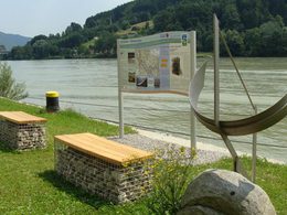
From the church in Niederranna, follow the road curve westwards and turn left after the parking lot of Gasthof Draxler. At the end of the road, a footpath continues to the Danube. The starting point is located about 50 m downstream from Gasthof Draxler (GPS: A-4085 Niederranna, Niederranna 3).
Public Transit
Niederranna can be reached by bus. A return transfer from Obermühl is basically possible by bus as well. But beware: there are no direct connections and travel times are usually several hours! Information about travel times can be found at http://www.ooevv.at .
Parking
In Niederranna, parking is free and unlimited at the sports ground parking lot. Directions: From the church in Niederranna, follow the road curve westwards. After about 230 m, the parking lot is on the right-hand side (village edge).
- Suitable for kids (all ages)
- Suitable for families
- Spring
- Summer
- Autumn
Please get in touch for more information.
Lindengasse 9
4040 Linz
Phone +43 732 7277 - 800
Fax machine +43 732 7277 - 804
E-Mail info@donausteig.com
Web www.donauregion.at
Web www.kirchberg-donau.at/
https://www.kirchberg-donau.at/
Altitude profile - Donausteig Stage 1_N03 Niederranna - Obermühl “Through the natural wonder of the Schlögen Loop”
Suggest changes
Please let us know how we can improve the quality of this object or if there is any incorrect information on this page (eg. opening hours, contact, etc.).
Please fill in all fields marked *.