


Pram Runde
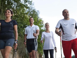


- Suitable for families
- Flatly
Interactive elevation profile
Create PDF
Tour-Details
Starting place: 4780 Schärding
Destination: 4780 Schärding
duration: 1h 15m
length: 8,8 km
Altitude difference (uphill): 11m
Altitude difference (downhill): 11m
Lowest point: 303m
Highest point: 317m
difficulty: medium
condition: medium
panoramic view: Some Views
Paths covering:
Asphalt, Gravel
powered by TOURDATA | Suggest a change
Longer, flat route to enjoy, together with the red route to Passauer Straße. Along the Pram to km 5.5 on natural ground that is easy on the joints, then back via Aigerding. Take a look at the baroque Orangery garden.... a feast for the eyes that you won't see again in a hurry.
Parking
- Parking space: 50
Payment methods
Other payment methods
Cash payment
- Suitable for groups
- Suitable for schools
- Suitable for single travelers
- Suitable for friends
- Suitable for couples
- Spring
- Summer
- Autumn
Please get in touch for more information.

Unterer Stadtplatz 1
4780 Schärding
Phone +43 7712 3154 - 0
Fax machine +43 7712 3154 - 0
E-Mail stadt@schaerding.ooe.gv.at
Web www.schaerding.at
http://www.schaerding.at
Interactive elevation profile
Create PDF
Tour-Details
Starting place: 4780 Schärding
Destination: 4780 Schärding
duration: 1h 15m
length: 8,8 km
Altitude difference (uphill): 11m
Altitude difference (downhill): 11m
Lowest point: 303m
Highest point: 317m
difficulty: medium
condition: medium
panoramic view: Some Views
Paths covering:
Asphalt, Gravel
powered by TOURDATA | Suggest a change
Suggest changes
Please let us know how we can improve the quality of this object or if there is any incorrect information on this page (eg. opening hours, contact, etc.).
Please fill in all fields marked *.