


Ins Kleine Kösslbachtal


- Suitable for kids (all ages)
- Flatly
Interactive elevation profile
Create PDF
Tour-Details
Starting place: 4090 St. Aegidi
Destination: 4090 St. Aegidi
duration: 3h 12m
length: 12,2 km
Altitude difference (uphill): 387m
Altitude difference (downhill): 389m
Lowest point: 279m
Highest point: 593m
difficulty: easy
condition: easy
panoramic view: Great panorama
Paths covering:
Asphalt, Hiking trail
powered by TOURDATA | Suggest a change
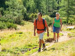
A very scenic and interesting hike on goods roads, forest roads and narrow paths that become slippery when wet. Hiking information
On the south side of the Danube valley, where the Sauwald rises as the Innviertel part of the granite highlands, there are several steep ditches. Like the Ranna Valley, they were formed millions of years ago, when the Danube was just beginning to carve its current path. The deeper it ate its way through the rock, the more its side streams cut into it. In contrast to the Ranna valley, however, we find a later stage of development in the Kleine Kösslbach valley (which is actually a Kesselbach valley): Here, the boulders blasted off during the Ice Age have already been overgrown by vegetation. This is also what gives it its romantic flavour, which is why it has been declared a nature reserve - as a sign at the start of our route reveals.
We follow the marked forest road through the steep, often rocky slopes above the Kleiner Kösslbach until we turn right onto the Mitterweg after about 30 minutes. On this narrow path, we climb higher between the almost jungle-like trees and the rustic boulder slopes of the Kösslbachleiten. The climate in the ravine forest is quite unique, humid and quite hot on hot midsummer days. Further up, the steepness of the terrain decreases and we reach the edge of the hilly plateau and thus the farmland. After approx. 2 km, we reach the Sigl inn in Atzersdorf on the road leading off to the left. As the name Vierviertelblick (four-quarter view) suggests, here you can really look out over all parts of the country - from the Bohemian Forest to the Hausruck and the Traunstein. If you don't want to return the same way, you can take a longer circular hike via Aichberg and Waldkirchen (marker no. 2). From there, take hiking trail no. 1 on an inclined descent through the Donauleiten to the Bräukapelle chapel (inside which a healing spring bubbles up) and to Wesenufer. Up to the Kösslbach bridge, you walk along the Danube on the Treppelweg and then another 500 metres alongside the main road - so if you are planning the long loop, you should start in Wesenufer and complete this section straight away.
Rest stops:
In Wesenufer, Atzersdorf, Aichberg and Waldkirchen
- Suitable for kids (all ages)
- Spring
- Summer
- Autumn
Please get in touch for more information.
St. Aegidi 10
4725 St. Aegidi
Phone +43 7717 7355 - 0
Fax machine +43 7717 7355 - 4
E-Mail gemeinde@st-aegidi.ooe.gv.at
Web www.st-aegidi.at
http://www.st-aegidi.at
Interactive elevation profile
Create PDF
Tour-Details
Starting place: 4090 St. Aegidi
Destination: 4090 St. Aegidi
duration: 3h 12m
length: 12,2 km
Altitude difference (uphill): 387m
Altitude difference (downhill): 389m
Lowest point: 279m
Highest point: 593m
difficulty: easy
condition: easy
panoramic view: Great panorama
Paths covering:
Asphalt, Hiking trail
powered by TOURDATA | Suggest a change
Suggest changes
Please let us know how we can improve the quality of this object or if there is any incorrect information on this page (eg. opening hours, contact, etc.).
Please fill in all fields marked *.