


Gießenbachklamm kleine Runde


- Flatly
Interactive elevation profile
Create PDF
Tour-Details
Starting place: 4360 Grein
Destination: 4360 Grein
duration: 1h 9m
length: 3,5 km
Altitude difference (uphill): 135m
Altitude difference (downhill): 135m
Lowest point: 408m
Highest point: 534m
difficulty: easy
condition: easy
panoramic view: Individual Views
Paths covering:
Hiking trail
powered by TOURDATA | Suggest a change
11a Giessenbach Gorge - circular route (2,400m)
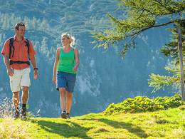
The starting point is the "Zur Aumühle" inn in the lovely Giessenbach valley above the romantic Stillensteinklamm gorge. The Gießenbachklamm gorge is located approx. 900 metres north of the Aumühle. Follow the path and enter the gorge from the goods road on the right. Above the small power station, a footbridge leads to the eastern bank. There you hike up the forest path through the romantic Gießenbachklamm gorge. Before the Klausmühle mill, which was still in operation until 1980, a footbridge leads to the right bank of the stream. From here, the trail continues southwards along the Giessenbach stream back to the Gasthof zur Aumühle.
The starting point is the "Zur Aumühle" inn in the lovely Giessenbach valley above the romantic Stillensteinklamm gorge. The Gießenbachklamm gorge is located approx. 900 metres north of the Aumühle. Follow the path and enter the gorge from the goods road on the right. Above the small power station, a footbridge leads to the eastern bank. There you hike up the forest path through the romantic Gießenbachklamm gorge. Before the Klausmühle mill, which was still in operation until 1980, a footbridge leads to the right bank of the stream. From here, the trail continues southwards along the Giessenbach stream back to the Gasthof zur Aumühle.
Most economical season
- Summer
Please get in touch for more information.
Nr. 20a
4362 Bad Kreuzen
mobile +43 681 20583484
E-Mail info@gsundleben.at
Web www.gsundleben.at
Web www.bad-kreuzen.at
http://www.gsundleben.at
http://www.bad-kreuzen.at
http://www.bad-kreuzen.at
Interactive elevation profile
Create PDF
Tour-Details
Starting place: 4360 Grein
Destination: 4360 Grein
duration: 1h 9m
length: 3,5 km
Altitude difference (uphill): 135m
Altitude difference (downhill): 135m
Lowest point: 408m
Highest point: 534m
difficulty: easy
condition: easy
panoramic view: Individual Views
Paths covering:
Hiking trail
powered by TOURDATA | Suggest a change
Suggest changes
Please let us know how we can improve the quality of this object or if there is any incorrect information on this page (eg. opening hours, contact, etc.).
Please fill in all fields marked *.