


Machland Bike Path R29


- Suitable for families
- Possible accommodation
Interactive elevation profile
Create PDF
Tour-Details
Path number: R29
Starting place: 4331 Naarn im Machlande
Destination: 4343 Mitterkirchen im Machland
duration: 1h 1m
length: 16,2 km
Altitude difference (uphill): 8m
Altitude difference (downhill): 10m
Lowest point: 232m
Highest point: 248m
difficulty: very easy
condition: very easy
panoramic view: Some Views
Paths covering:
Asphalt
powered by TOURDATA | Suggest a change
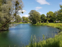
The Machland Bike Path offers a combination of biking enjoyment and cultural entertainment.
The starting point is Au an der Donau, where the Machland Bike Path branches off from the Danub e Bike Path. First, you pedal through the fertile Machland via Naarn to Perg. Then it's time to go south to Mitterkirchen, where you should visit the Keltendorf open-air museum. Right nextdoor, you can find a connection back to the Danube Bike Path.
Designation: R29 (Within the network of national bike paths in Upper Austria)
Starting point: Danube Bike Path in Au an der Donau
Destination: Danube Bike Path in Mitterkirchen
further information:
- Possible accommodation
- Board possible
Accessibility / arrival
By car:
A1 motorway to exit Enns-Steyr or St Valentin towards Mauthausen (Donaubrücke) - Bundesstraße 3 to Perg - take the branch going to Naarn.
By rail:
The closest railway station is in Perg, 4 kilometres away from Naarn.
Most economical season
- Spring
- Summer
- Autumn
- Early winter
Please get in touch for more information.
4331 Naarn im Machlande
Phone +43 7262 58255
E-Mail gemeinde@naarn.ooe.gv.at
Web www.naarn.at
https://www.naarn.at
Interactive elevation profile
Create PDF
Tour-Details
Path number: R29
Starting place: 4331 Naarn im Machlande
Destination: 4343 Mitterkirchen im Machland
duration: 1h 1m
length: 16,2 km
Altitude difference (uphill): 8m
Altitude difference (downhill): 10m
Lowest point: 232m
Highest point: 248m
difficulty: very easy
condition: very easy
panoramic view: Some Views
Paths covering:
Asphalt
powered by TOURDATA | Suggest a change
Suggest changes
Please let us know how we can improve the quality of this object or if there is any incorrect information on this page (eg. opening hours, contact, etc.).
Please fill in all fields marked *.